About
INSPIRE is a European Union (EU) Directive that came into force on May 15, 2007 with the aim to create a common spatial data infrastructure for the purposes of EU environmental policies and policies or activities which may have an impact on the environment.
One of the major goals is to create harmonised spatial data sets that can be used seamlessly in cross-border applications.
In order to reach this goal common data specifications have been agreed for 34 themes as well as technical requirements for their publication via network services.
Details of the Directive and the policy background leading to its adoption can be found in the background section.
Why should I use INSPIRE?
INSPIRE makes it easier to find, use and re-use (spatial) data.
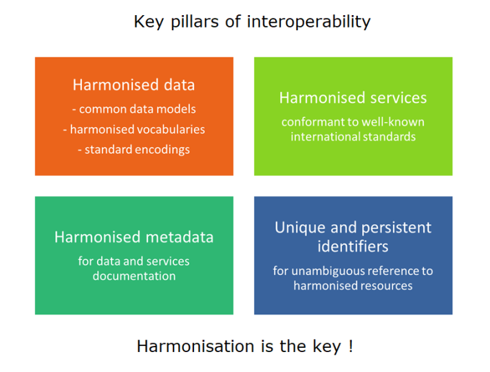
By using a "common language" - i.e. common rules for documenting, structuring, classifying, sharing via web services, etc. - INSPIRE data sets and services are interoperable.
Can I benefit from emerging technologies while using INSPIRE?
The INSPIRE framework is evolving to provide for modernisation and simplification of the technology stack. The aim is to better support data-driven decision making while opening up to a wider range of (spatial and non-spatial) users and contribute to the Green Deal Data Space.
In this regard, the Good Practice streamlined procedure has been adopted to propose, document and publish good implementation practices, e.g. extensions/profiles for specific application domains or emerging technologies, and share them with the wider INSPIRE community. Examples of Good Practices are INSPIRE Download Services based on the OGC API-Features standard and the GeoPackage encoding of INSPIRE datasets.
Where can I find INSPIRE data?
The INSPIRE Geoportal provides the central access point into the INSPIRE metadata, data and services.
Can I extend INSPIRE data specifications?
While INSPIRE data specifications address many basic use cases, they often need to be extended to serve national as well as domain specific needs. This is not a problem! The INSPIRE core data models are designed to be extensible.
Make INSPIRE work for you! Watch this short video using the example of the energy efficiency of building to demonstrate how to make INSPIRE work for you.
Find best practices for extending INSPIRE models and a step by step tutorial on how to extend INSPIRE data specifications can be found on the INSPIRE Data Specification Extension website.
How can I use INSPIRE data and services?
INSPIRE data and services can be used for a large variety of applications, to support e.g.
- Implemention and monitoring of enviromental policies including environmental reporting and easy access of environmental information for the public
- eGovernment strategies
- Other policy areas (e.g. disaster management, agriculture, mobility, energy, industry)
- Copernicus Programme
- Data economy
What tools and resources are available?
A number of training resources are available in the Training Library. Among others, find there modules on ‘Monitoring and understanding emerging geospatial technologies’, ‘Principles for Data and Metadata Harmonisation according to INSPIRE’ and a ‘Short video on benefits of INSPIRE’.
The tools and resources repository provides access to resources developed by the INSPIRE EC/EEA team.
Where do I find support?
INSPIRE helpdesks and discussion platforms are operated and managed in the dedicated Maintenance and Implementation GitHub space.
What's happening in my country?
Each Member State is obliged to ensure that appropriate structures and mechanisms are designed for coordinating, across the different levels of government, the contributions of all those with an interest in their infrastructures for spatial information.
The INSPIRE in your country section provides information for the individual countries.

